
Finally!! We feel immense pleasure and proud that we have incorporated (S)ECA distance in sea route measurement. It was a long due promise from our side which is going to deliver now.
Few days back we introduced the feature in which user can include/exclude Suez canal and Panama Canal from route. And now with (S)ECA distance our system become more accurate and useful for all our users.
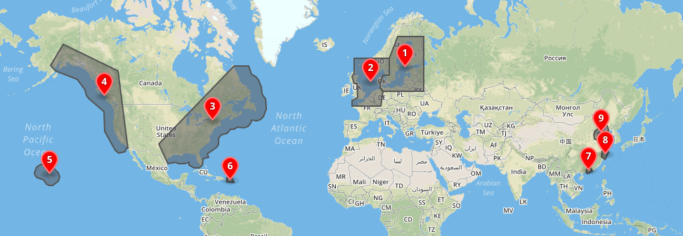
What consist of (S)ECA zone in our system:
Our system includes most extensive list of region in (S)ECA zone, which are: 1. Baltic Sea 2. North Sea and English Channel 3. US East Cost 4. US West Cost 5. Hawaiian Islands 6. Caribbean (Puerto Rico and US Virgin Islands) 7. Pearl River Delta 8. Yangtze River Delta 9. Bohai Gulf
How this is going to work? From now on our sea distance system will provide two distance values- 1. Overall distance between two points 2. (S)ECA zone distance out of overall distance between two points
This will not only limited to our Explorer app user but also available in our API.
See Updated API documentation:
Stay tune for our all new product which would be launch this month. And don’t forget to send your feedback and queries.
From Aquaplot with ♥